VolcanoMods
Platinian On Fire
Playstore Link:

OsmAnd+ — Maps & GPS Offline - Apps on Google Play
Navigation on hikes is no longer a problem. Download the map, put notes and go!
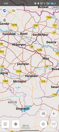
Osmand+ is an open source navigation application with access to a wide variety of global open street map data. All map data (vector or tile maps) can be stored on the phone memory card for offline usage. Osmand also offers offline and online routing functionality including voice guidance.
Osmand+ is the paid application version, by buying it you support the project, fund the development of new features, and receive the latest updates.
Some of the core features:
- Complete offline functionality (store downloaded vector or tile maps in a selectable folder)
- Compact offline vector maps for the whole world available
- Unlimited downloading of country or region maps directly from the app
- Offline Wikipedia feature (download Wikipedia POIs), great for sightseeing
- Overlay of several map layers possible, like GPX or navigation tracks, Points of Interest, favorites, contour lines, public transportation stops, additional maps with customizable transparency
- Offline search for addresses and places (POIs)
- Offline routing for short distances (experimental)
- Car, bicycle, and pedestrian modes with:
- Optional automated day/night view switching
- Optional speed-dependent map zooming
- Optional map alignment according to compass or direct
ion of motion
*Special Features*
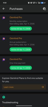
1. premium unlocked
Free Download:
! Hidden Content !
You must be registered and either click Like under this post or leave a comment before you can see the hidden links.
You may need to refresh the page after clicking Like. If you’re still having trouble revealing the hidden links, please
read this.
Did you know? VIP Members can see all links instantly, no unlocking required.
Interested? Get VIP here.
Interested? Get VIP here.